MAKE A MEME
View Large Image
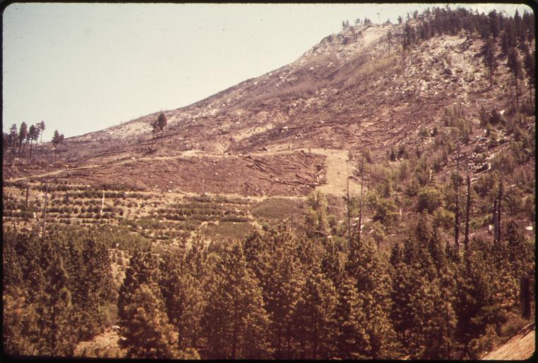
| View Original: | TERRACED_AREA_FOR_TREE_PRODUCTION,_SHOWING_EFFECTS_OF_CONTROLLED_BURNING_WHICH_DESTROYED_FIFTY_ACRES_-_NARA_-_542600.tif (3000x2027) | |||
| Download: | Original | Medium | Small | Thumb |
| Courtesy of: | commons.wikimedia.org | More Like This | ||
| Keywords: TERRACED AREA FOR TREE PRODUCTION, SHOWING EFFECTS OF CONTROLLED BURNING WHICH DESTROYED FIFTY ACRES - NARA - 542600.tif Scope and content General notes 542600 Local identifier 412-DA-107 Environmental Protection Agency 12/02/1970 - NARA-Author Daniels Gene photographer Photographer 8463941 <br /> Sierra National Forest Madera county California United States North and Central America forest 4027340 37 417 -119 17 <br /> Still Picture Records Section Special Media Archives Services Division NWCS-S National Archives at College Park 8601 Adelphi Road College Park MD 20740-6001 1972 05 Record group Record Group 412 Records of the Environmental Protection Agency 1944 - 2006 Record group ARC 708 DOCUMERICA The Environmental Protection Agency's Program to Photographically Document Subjects of Environmental Concern compiled 1972 - 1977 Series ARC 542493 File unit File unit ARC Variant control numbers Agency-Assigned Identifier 002/47/000000<br /> NAIL Control Number NWDNS-412-DA-107 yes Other versions <gallery> File TERRACED_AREA_FOR_TREE_PRODUCTION _SHOWING_EFFECTS_OF_CONTROLLED_BURNING_WHICH_DESTROYED_FIFTY_ACRES_-_NARA_-_542600 tif tif File TERRACED_AREA_FOR_TREE_PRODUCTION _SHOWING_EFFECTS_OF_CONTROLLED_BURNING_WHICH_DESTROYED_FIFTY_ACRES_-_NARA_-_542600 jpg jpg </gallery> NARA-cooperation PD-USGov Logging in the United States NARA TIF images with categorized JPGs | ||||