MAKE A MEME
View Large Image

| View Original: | US_Navy_050705-N-0000X-004_Satellite_image_showing_low_cloud,_infrared_and_vapor_reflections_of_three_tropical_storms.jpg (800x600) | |||
| Download: | Original | Medium | Small | Thumb |
| Courtesy of: | commons.wikimedia.org | More Like This | ||
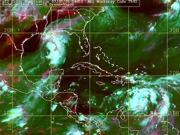
| Keywords: US Navy 050705-N-0000X-004 Satellite image showing low cloud, infrared and vapor reflections of three tropical storms.jpg en Gulf of Mexico July 5 2005 Satellite image showing low cloud infrared and vapor reflections of three tropical storms Tropical storm Dora located off the coast of Mexico in the Pacific Ocean moved toward the southwestern coast of Mexico where storm warnings were posted Maximum sustained winds were at 40 mph Forecasters did not expect it to strengthen significantly Tropical storm Cindy located in the Gulf of Mexico is expected to make landfall by Wednesday At 8 a m EDT Cindy was about 200 miles south-southwest of the mouth of the Mississippi River and moving north at 14 mph Tropical storm-force wind and rain extended up to 85 miles to the north and east from its center Tropical storm Dennis the 4th tropical storm of the season has sustained winds of 45mph and is expected to grow into a hurricane Dennis is presently located in the southeast Caribbean Dennis was about 415 miles south-southeast of San Juan Puerto Rico and moving west at about 17 mph The depression was on track to reach Haiti by Wednesday and South Florida by Friday The Atlantic hurricane season began June 1 and ends Nov 30 Photo provided by Naval Atlantic Meteorology and Oceanography Center RELEASED For more information visit <a href https //weather navy mil Target _BLANK >https //weather navy mil</a> 2005-07-05 050705-N-0000X-004 Navy http //www navy mil/view_image asp id 25876 U S Navy photo PD-USGov-Military-Navy Satellite pictures of multiple tropical cyclones | ||||