MAKE A MEME
View Large Image

| View Original: | Usambara 1889 B002.png (6497x5616) | |||
| Download: | Original | Medium | Small | Thumb |
| Courtesy of: | commons.wikimedia.org | More Like This | ||
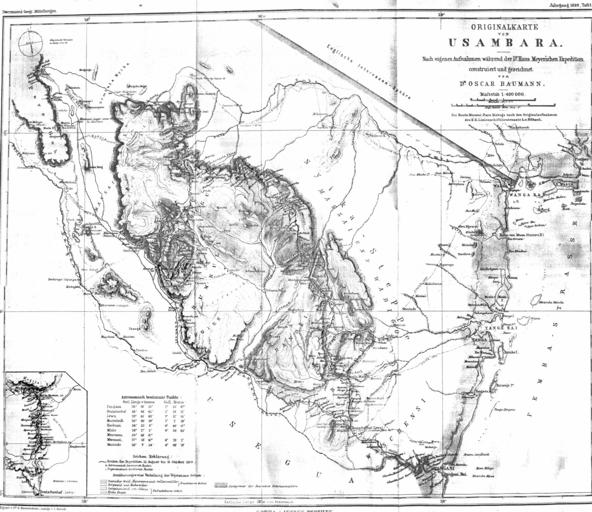
| Keywords: Usambara 1889 B002.png en caption Original map of Usambara - After own recordings designed and drawed by Dr Oscar Baumann during the expedition of Dr Hans Meyer <br /> map with astronomical postion fixings Originalkarte von Usambara - Nach eigenen Aufnahmen während der Dr Hans Meyerschen Expedition construiert und gezeichnet von Dr Oscar Baumann Karte mit astronomischen Ortsbestimmungen File Usambara 1889 Baumann djvu Dr A Petermanns Mitteilungen aus Justus Perthes Geographischer Anstalt Gotha vol 35 1889 suppl Oscar Baumann travels recording drawing <br />C Barich autography of the map <br />B Hassenstein edit <br /> Justus Perthes Geographische Anstalt zu Gotha publishing company 1889 PD-old-100 <ins>Notice in legend</ins> <br />The route Marurui-Pare Maboga after the original recordings of the Imperial and Royal Austrian Battleship Lieutenant L von Höhnel <ins>Notiz in der Legende</ins> <br />Die Route Maurui-Pare Maboga nach den Originalaufnahmen des K K Linienschifflieutenants L v Höhnel 1889 maps Usambara Mountains Maps of the German East Africa Old maps of Tanzania | ||||