MAKE A MEME
View Large Image
| View Original: | VA Tech massacre aerial photo of referenced locations.jpg (765x767) | |||
| Download: | Original | Medium | Small | Thumb |
| Courtesy of: | commons.wikimedia.org | More Like This | ||
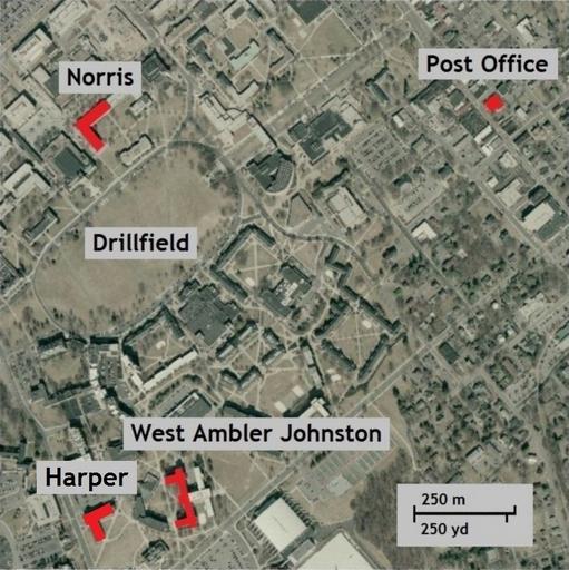
| Keywords: VA Tech massacre aerial photo of referenced locations.jpg en Map of Virginia Tech campus and downtown Blacksburg VA with Norris Hall West Ambler Johnston Hall and the U S Post Office shown in red with labels Base map from TerraServer USGS 2014-05-23 USGS TerraServer map edited to highlight locations on VA Tech campus and in Blacksburg VA From the USGS Abstract These files contain Digital Orthophoto files for the State of Virginia developed from imagery acquired in spring 2006 and 2007 D'Ranged 1 File Norris WestAJ Map scale jpg; File Norris_WestAJ_Map jpg This version includes the U S Post Office in Blacksburg VA and corrects the spelling of Drillfield to one word I created this using original maps from the USGS not the previous versions cc-zero PD-USGov-USGS Virginia Tech massacre | ||||