MAKE A MEME
View Large Image

| View Original: | Verbreitung_der_Konfessionen_im_deutschen_Reich.jpg (3160x2547) | |||
| Download: | Original | Medium | Small | Thumb |
| Courtesy of: | commons.wikimedia.org | More Like This | ||
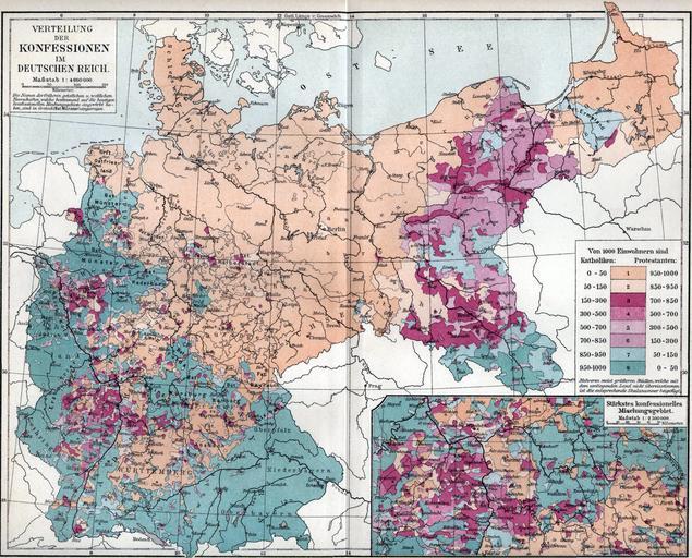
| Keywords: Verbreitung der Konfessionen im deutschen Reich.jpg Map showing distribution of Catholics and Protestants in the German Reich as of the 1890s For a full discussion of this map including detailed statistics from the original source and written in German see the talk page Map owned and scanned by Angr 1893 “97 Meyers Konversationslexikon 5th edition Public domain PD-old Old maps of the German Empire Maps of the religion history of Germany Germany Catholic Protestants 1890s Maps of Evangelical Church in Germany Germany Catholic Protestants 1890s Maps from Meyers Konversationslexikon History of Christianity in Germany | ||||